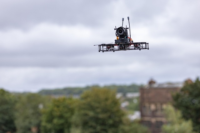
How Drones Fly and Explore the World Around Us
Drones are small flying machines that people can control from the ground. They can move up, down, and around in the air. Many drones have cameras that show pictures and videos from high above. Learning about drones can help us understand how they work and what they can do in science, photography, and fun projects.

The rise of unmanned aerial vehicles has opened new possibilities across industries and hobbies alike. These versatile machines combine aerodynamics, electronics, and software to navigate three-dimensional space with precision. Whether used for professional applications or recreational purposes, drones have become essential tools for capturing perspectives previously accessible only through helicopters or fixed-wing aircraft. Their ability to hover, maneuver through tight spaces, and carry various payloads makes them invaluable for countless applications.
What Makes Drones Stay Airborne?
The fundamental principle behind drone flight involves generating enough upward force to counteract gravity. Most consumer and commercial drones use multiple rotors, typically four, six, or eight, arranged in a symmetrical pattern. Each rotor consists of a motor and propeller that spins rapidly to push air downward, creating an equal and opposite reaction that lifts the drone upward. By varying the speed of individual rotors, the drone can tilt, rotate, and move in any direction. Flight controllers continuously adjust rotor speeds thousands of times per second, responding to pilot inputs and sensor data to maintain stable flight. Gyroscopes detect orientation changes, accelerometers measure movement, and barometers track altitude, all working together to keep the aircraft level and responsive.
How Are Drone Services Used Across Industries?
Professional drone services have expanded rapidly as businesses recognize the efficiency and safety benefits these aircraft provide. Construction companies use drones to monitor project progress, creating detailed site maps and identifying potential issues before they become costly problems. Agricultural operations employ drones equipped with multispectral cameras to assess crop health, optimize irrigation, and reduce pesticide use. Emergency services deploy drones to search for missing persons, assess disaster damage, and deliver medical supplies to remote locations. Real estate agents showcase properties with aerial photography that highlights surrounding neighborhoods and amenities. Infrastructure inspectors examine bridges, power lines, and telecommunications towers without putting workers at risk. The versatility of drone platforms allows operators to customize payloads and capabilities for specific tasks, making them adaptable to diverse professional requirements.
What Does a Drone Cinematography Course Teach?
Learning to capture professional-quality aerial footage requires more than basic piloting skills. A structured drone cinematography course covers camera settings, composition principles, and movement techniques that create cinematic results. Students learn to plan flight paths that reveal subjects gradually, use smooth gimbal movements to enhance storytelling, and adjust exposure settings for varying light conditions. Understanding frame rates, shutter speeds, and color grading helps cinematographers match aerial footage with ground-based shots seamlessly. Courses also emphasize safety protocols, airspace regulations, and risk assessment procedures that protect people, property, and the aircraft itself. Advanced training includes working with directors, coordinating with ground crews, and managing multiple aircraft for complex productions. Many programs incorporate practical exercises where students film real projects, receiving feedback from experienced instructors who have worked on commercial productions.
How Does Drone Surveying Improve Accuracy?
Traditional land surveying methods require extensive time and labor to measure terrain, document boundaries, and create topographic maps. Drone surveying revolutionizes this process by capturing thousands of high-resolution images from multiple angles, which specialized software processes into detailed three-dimensional models. Photogrammetry techniques analyze overlapping images to calculate precise distances and elevations, often achieving accuracy within centimeters. LiDAR-equipped drones emit laser pulses that penetrate vegetation, revealing ground surfaces beneath forest canopies and dense brush. Mining operations use drone surveys to calculate stockpile volumes, track excavation progress, and ensure compliance with environmental regulations. Urban planners rely on drone-generated models to visualize development proposals and assess infrastructure needs. The speed and cost-effectiveness of drone surveying make it practical to conduct regular updates, enabling project managers to track changes over time and respond quickly to emerging challenges.
What Advanced Skills Does a Drone Cinematography Masterclass Provide?
Beyond foundational techniques, a drone cinematography masterclass delves into sophisticated approaches that distinguish professional work from amateur footage. Participants explore advanced flight modes like orbit, cable cam, and waypoint navigation that create repeatable, precise camera movements. Instruction covers working with larger cinema drones that carry professional camera systems, requiring different handling techniques and safety considerations. Masterclass sessions often include case studies from feature films, documentaries, and commercial productions, analyzing how directors and cinematographers achieved specific visual effects. Students learn to scout locations effectively, obtaining necessary permits and coordinating with aviation authorities. Post-production workflows receive detailed attention, including stabilization techniques, color matching across multiple shots, and integrating aerial footage into larger editing projects. Networking opportunities with industry professionals and collaborative projects help participants build portfolios that demonstrate their capabilities to potential clients and employers.
Conclusion
The technology enabling drones to fly and explore has matured rapidly, transforming these aircraft from experimental devices into reliable tools for countless applications. Understanding the physics of flight, mastering cinematography techniques, and applying surveying methodologies all contribute to effective drone operation. As regulations evolve and capabilities expand, drones will continue opening new possibilities for capturing perspectives, gathering data, and solving problems that once seemed insurmountable. Whether pursuing professional certification or exploring aerial photography as a hobby, learning to operate drones skillfully offers rewarding opportunities to see the world from entirely new angles.


