How Drones Fly and Explore the World Around Us
Drones are small flying machines that people can control from the ground. They can move up, down, and around in the air. Many drones have cameras that show pictures and videos from high above. Learning about drones can help us understand how they work and what they can do in science, photography, and fun projects.

Drones have transformed from niche hobbyist gadgets into versatile tools used across numerous industries. Their ability to access hard-to-reach locations and capture aerial data has made them invaluable for everything from filmmaking to agriculture. Understanding how these remarkable machines work and their diverse applications provides insight into why they’ve become such a revolutionary technology in recent years.
How Do Drones Actually Fly?
Drones achieve flight through a combination of propulsion systems, sensors, and sophisticated flight controllers. Most consumer and professional drones use multiple rotors (typically four, six, or eight) that generate lift by pushing air downward. These multirotor configurations provide stability and maneuverability that fixed-wing aircraft cannot match in confined spaces.
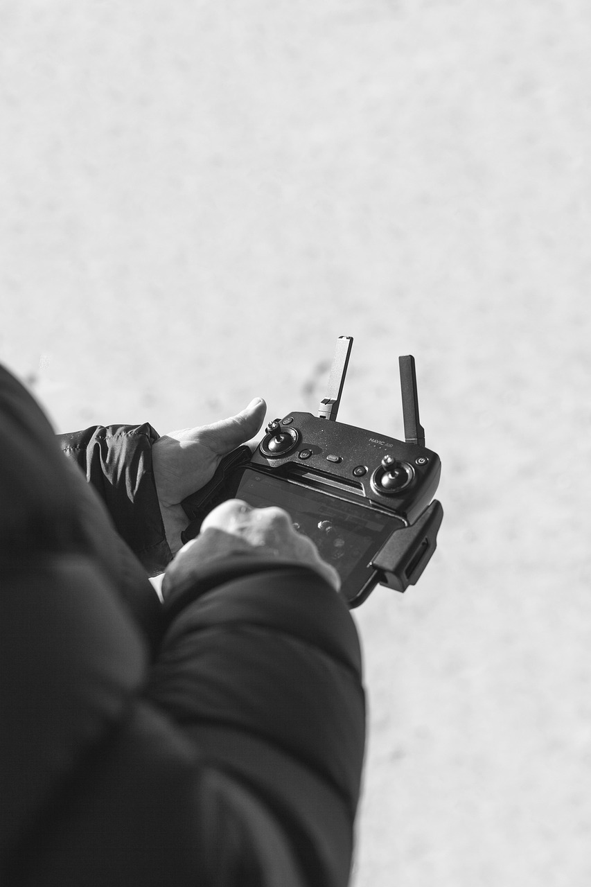
The heart of a drone’s flight capability lies in its flight controller - essentially a specialized computer that processes data from various sensors including gyroscopes, accelerometers, barometers, and GPS receivers. These sensors constantly monitor the drone’s orientation, altitude, and position, making thousands of calculations per second to maintain stability. When a pilot sends commands through a remote controller, the flight controller adjusts the speed of individual motors to execute precise movements.
Modern drones also incorporate obstacle avoidance systems using visual, ultrasonic, or infrared sensors that detect objects in the drone’s path and automatically adjust flight paths to prevent collisions. This technology has made drone flying more accessible even to beginners while enhancing safety for all users.
What Makes Drone Cinematography Courses Essential?
Drone cinematography has revolutionized visual storytelling across film, television, and online media. However, capturing professional-quality aerial footage requires much more than simply flying a drone and pressing record. Specialized drone cinematography courses teach pilots the technical and artistic skills needed to create compelling aerial visuals.
A comprehensive drone cinematography masterclass typically covers essential techniques like revealing shots, orbiting movements, tracking shots, and complex maneuvers that create dynamic visual narratives. Students learn how to plan shots effectively, considering factors like lighting conditions, time of day, weather, and location constraints. These courses also address critical post-production workflows, including color grading and editing techniques specific to aerial footage.
Beyond creative aspects, professional drone cinematography courses cover regulatory requirements, safety protocols, and flight planning. Understanding airspace restrictions, obtaining necessary permissions, and implementing risk assessment procedures are essential components of professional drone operation for media production. As regulations continue to evolve, staying current through structured education becomes increasingly valuable for serious drone cinematographers.
How Are Drone Services Transforming Industries?
Drone services have expanded far beyond photography and videography, creating entirely new business models and improving efficiency across numerous sectors. In agriculture, drones equipped with multispectral cameras help farmers monitor crop health, optimize irrigation, and detect pest infestations early. This precision agriculture approach can significantly reduce resource usage while increasing yields.
In infrastructure inspection, drones provide safe, cost-effective alternatives to traditional methods. Power line inspections that once required helicopters or climbing crews can now be completed more frequently and with greater detail using specialized drones. Similar benefits apply to inspections of bridges, cell towers, wind turbines, and other tall structures where human access presents significant safety risks.
Emergency services increasingly rely on drone services for search and rescue operations, disaster assessment, and firefighting support. Thermal cameras mounted on drones can locate missing persons in difficult terrain or identify hotspots in wildfires, providing critical information to ground teams. The ability to rapidly deploy drones and transmit real-time data makes them invaluable tools in time-sensitive emergency scenarios.
What Does Drone Surveying Involve?
Drone surveying has revolutionized how we capture and analyze geographical data. Using specialized drones equipped with high-resolution cameras, LiDAR sensors, or multispectral imaging systems, surveyors can create detailed maps, 3D models, and topographical surveys with unprecedented efficiency and accuracy.
The process typically begins with mission planning, where flight paths are programmed to ensure complete coverage of the target area with appropriate overlap between images. During flight, the drone systematically captures hundreds or thousands of geo-tagged images. These images are then processed using photogrammetry software that identifies common points across multiple photos to generate detailed point clouds and 3D models.
The applications for drone surveying span numerous fields including construction, mining, archaeology, and environmental monitoring. Construction companies use drone surveys to track progress, calculate material volumes, and verify that projects adhere to plans. Mining operations employ drones to measure stockpile volumes and monitor site changes over time. Environmental scientists utilize drone surveys to assess erosion patterns, vegetation health, and habitat changes with minimal ecosystem disruption.
What Equipment and Training Do Professional Drone Operators Need?
Professional drone operation requires significant investment in both equipment and education. Commercial-grade drones used for professional services typically cost between $1,500 and $30,000 depending on their capabilities, with specialized models for cinematography, surveying, or industrial inspection commanding premium prices. Beyond the aircraft itself, operators need multiple batteries, controllers, monitors, specialized sensors, and transportation cases.
| Training Program | Focus Area | Approximate Cost | Duration |
|---|---|---|---|
| Drone Cinematography Masterclass | Creative filming techniques | $1,200-$3,500 | 3-5 days |
| Drone Surveying Certification | Mapping and data processing | $1,800-$4,000 | 1-2 weeks |
| Commercial Drone License Prep | Regulatory compliance | $300-$1,500 | 2-5 days |
| Advanced Flight Training | Complex maneuvers | $800-$2,000 | 3-7 days |
Prices, rates, or cost estimates mentioned in this article are based on the latest available information but may change over time. Independent research is advised before making financial decisions.
Regulatory requirements vary by country, but most jurisdictions require commercial drone operators to obtain specific licenses or certifications. In many countries, this involves passing knowledge tests covering airspace regulations, weather patterns, flight operations, and emergency procedures. Professional operators must also maintain insurance coverage, understand privacy laws, and stay current with evolving regulations.
The Future of Drone Technology and Applications
Drone technology continues to evolve rapidly, with several trends shaping its future development. Battery technology improvements are gradually extending flight times beyond the current 20-30 minute average for professional models. Meanwhile, autonomous capabilities are becoming more sophisticated, allowing drones to execute complex missions with minimal human intervention.
Beyond visual line of sight (BVLOS) operations represent one of the most significant regulatory frontiers for drone services. As regulatory frameworks adapt to permit carefully controlled BVLOS flights, applications like long-distance infrastructure inspection and drone delivery services will become more viable. Several countries have begun implementing drone traffic management systems to safely integrate unmanned aircraft into increasingly crowded airspace.
The miniaturization of sensors and computing hardware is enabling drones to carry increasingly sophisticated payloads while maintaining manageable sizes. This trend is particularly important for specialized applications like environmental monitoring, where drones may need to carry multiple sensor types simultaneously. As artificial intelligence capabilities advance, drones will increasingly process and analyze data onboard rather than merely collecting it for later analysis, enabling real-time decision making and adaptive mission planning.


