How Drones Fly and Explore the World Around Us
Drones are small flying machines that people can control from the ground. They can move up, down, and around in the air. Many drones have cameras that show pictures and videos from high above. Learning about drones can help us understand how they work and what they can do in science, photography, and fun projects.

Drones have transformed our ability to observe and interact with environments from above. These remarkable flying machines combine multiple technologies to achieve stable flight while carrying cameras and sensors that capture data about the world below. From hobbyists capturing stunning aerial footage to professionals conducting complex surveys, drones have opened up new possibilities for exploration and documentation that were once impossible or prohibitively expensive.
How Drone Technology Enables Flight
Drones achieve flight through a combination of sophisticated components working in harmony. Most consumer and professional drones use multiple rotors (typically four, six, or eight) that provide lift and directional control. These multirotor designs rely on precise motor control systems that adjust the speed of individual rotors to maintain stability and respond to pilot commands.
At the heart of a drone’s flight capability is its flight controller—essentially a specialized computer that processes data from various sensors including accelerometers, gyroscopes, and barometers. These sensors constantly measure the drone’s orientation, altitude, and movement, allowing the flight controller to make thousands of tiny adjustments per second to keep the drone stable even in changing wind conditions.
Modern drones also incorporate GPS technology that enables position holding, autonomous flight paths, and return-to-home safety features. More advanced models include obstacle avoidance sensors that use visual, infrared, or ultrasonic technology to detect and navigate around objects in their path.
Exploring the World Through Drone Cinematography
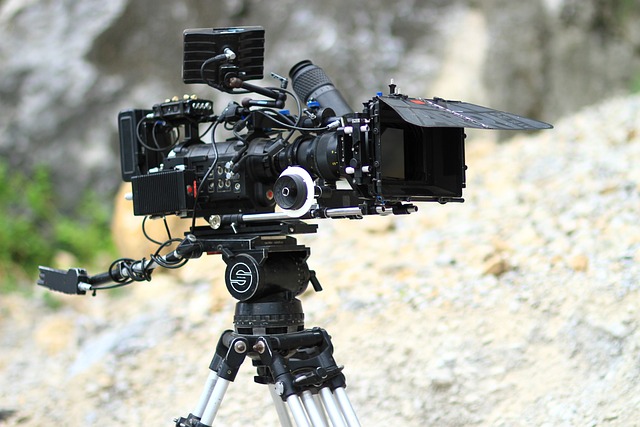
Drone cinematography has revolutionized visual storytelling by providing perspectives previously achievable only with expensive helicopter rentals or specialized equipment. The ability to capture smooth, dynamic aerial shots has transformed filmmaking, documentary production, and commercial photography.
Professional drone pilots master techniques such as reveal shots (gradually exposing a landscape), orbit movements (circling subjects), and dolly zooms (moving the drone while adjusting focal length). These techniques create cinematic effects that add drama and context to visual narratives.
A comprehensive drone cinematography course typically covers essential skills like flight planning, camera settings optimization, and post-production techniques. Students learn to consider factors such as lighting conditions, time of day, and weather patterns to achieve optimal results. Advanced courses also address regulatory requirements and safety protocols, ensuring pilots operate legally and responsibly while capturing stunning footage.
Drone Surveying Applications and Techniques
Drone surveying has transformed industries like construction, agriculture, and environmental monitoring by providing accurate, timely data collection capabilities. Using specialized sensors and cameras, drones can create detailed topographic maps, 3D models, and volumetric measurements with remarkable precision.
The process typically begins with flight planning software that ensures systematic coverage of the target area. During flight, drones capture hundreds of overlapping images with embedded GPS coordinates. These images are then processed using photogrammetry software that identifies common points across multiple photos to build accurate models and maps.
The advantages of drone surveying over traditional methods are significant. Data collection that once took days or weeks can now be completed in hours. Areas that were dangerous or impossible to access on foot can be surveyed safely. The resulting datasets are often more comprehensive and can be analyzed digitally, allowing for measurements, comparisons over time, and integration with other data sources.
Professional Drone Services Across Industries
The proliferation of drone technology has given rise to specialized drone services catering to diverse industry needs. These professional operators combine technical expertise with industry-specific knowledge to deliver valuable insights and solutions.
In agriculture, drone services provide crop health monitoring through multispectral imaging that identifies stress patterns invisible to the human eye. Construction companies utilize drone services for progress monitoring, volumetric calculations of earthworks, and safety inspections of tall structures.
Insurance companies employ drone services for rapid damage assessment following natural disasters, while real estate professionals use aerial photography and videography to showcase properties from appealing perspectives. Environmental researchers leverage drone services to monitor wildlife populations, track changes in ecosystems, and assess the impact of climate change without disturbing sensitive habitats.
Mastering Drone Operations Through Professional Training
Becoming proficient in drone operation requires more than just purchasing equipment. Professional drone cinematography masterclasses offer structured pathways to develop technical skills and creative vision. These comprehensive training programs typically combine theoretical knowledge with hands-on flight practice.
A quality drone cinematography masterclass covers essential topics including equipment selection, camera settings optimization, composition techniques, and post-production workflows. Students learn to plan shots effectively, considering factors such as sun position, background elements, and subject movement. Advanced courses address complex maneuvers that create dynamic visual storytelling opportunities.
Beyond creative aspects, professional training programs also address regulatory compliance, risk assessment, and operational safety. Participants learn to navigate airspace restrictions, weather limitations, and equipment failures while maintaining professional standards throughout their operations.
Drone Equipment and Technology Comparison
Understanding the available drone technology options helps professionals select the right tools for specific applications. The market offers various models with different capabilities and price points.
| Drone Category | Typical Cost Range | Key Features | Best Applications |
|---|---|---|---|
| Entry-Level Consumer | $300-$800 | 20-30 minute flight time, 4K camera, basic stabilization | Recreational photography, learning fundamentals |
| Advanced Consumer | $800-$1,500 | 30+ minute flight time, 4K/60fps camera, 3-axis gimbal | Social media content, real estate, basic inspections |
| Prosumer | $1,500-$3,000 | Interchangeable cameras, obstacle avoidance, automated flight modes | Professional photography, cinematography, light commercial work |
| Professional | $3,000-$10,000+ | High-end cameras, extended flight time, advanced safety features | Film production, surveying, industrial inspection |
| Specialized Industrial | $10,000-$50,000+ | Custom sensors, RTK positioning, thermal/multispectral imaging | Precision mapping, infrastructure inspection, scientific research |
Prices, rates, or cost estimates mentioned in this article are based on the latest available information but may change over time. Independent research is advised before making financial decisions.
The rapid evolution of drone technology continues to expand possibilities across industries. As regulations mature and technology advances, drones will become increasingly integrated into our methods of exploring, documenting, and understanding the world around us. Their ability to access perspectives and gather data from previously inaccessible vantage points represents a significant advancement in our capacity to observe and interact with our environment.


